Smart City
Insight into how your city moves, from junction to square.
Bike D Tec Smart City turns camera footage into data on traffic and pedestrian flows, modal split and the use of public space. City planners, mobility teams and public organisations get an up-to-date picture of their city to improve services and back investment decisions.

From problem to result


-
01 The problem
A city that changes faster than its figures
Cities are complex, living systems. Traffic shifts after a redesign, squares are used differently than planned, events draw unexpected crowds. Policy then rests on counts that are years old, or on assumptions nobody ever tested.
-
02 Our approach
Turning camera footage into city data
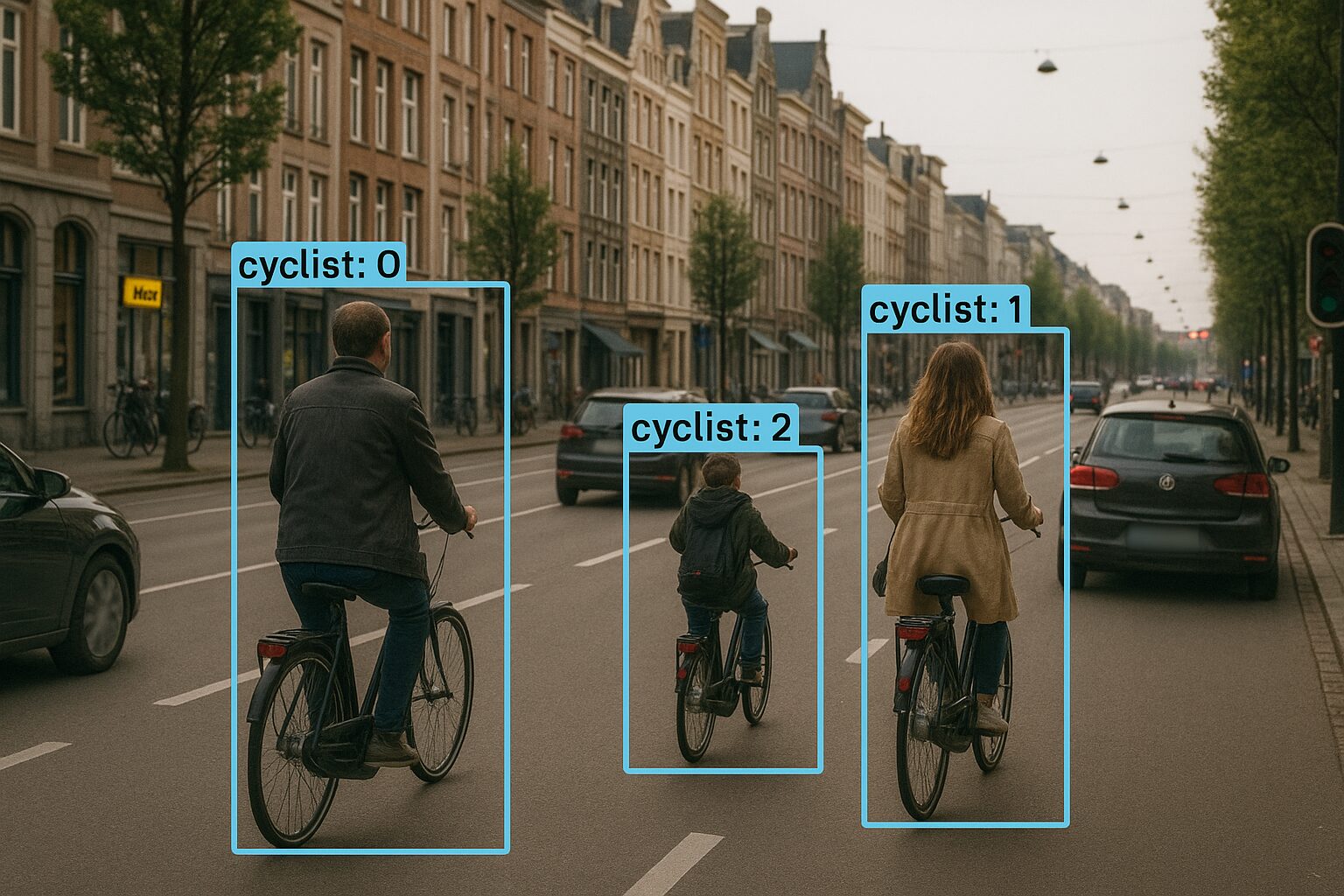
Our AI recognises and counts the road users in view, from pedestrians to trucks, with no ground sensors or manual counts. That gives you a clear picture of:
- traffic and pedestrian flows;
- modal split by street and by hour;
- how squares and public spaces are used, and how busy they get;
- crowds around events.
-
03 The result
Evidence-based decisions for a liveable city
You see, live and over longer periods, how your city is used. You put resources where they have the most effect, evaluate interventions with facts and engage residents with clear figures. From a first pilot to a city-wide rollout, the approach scales with your ambitions.
How it works
-
01
Consultation
We come on site, translate your policy questions into measurable indicators and look at the cameras already in place.
-
02
Tailored plan
We choose locations and analyses, from a single pilot site to a city-wide network.
-
03
Installation and go-live
We install or connect the cameras and make the data available in a dashboard or through an API.
-
04
Ongoing support
We monitor the system, expand where needed and help you turn the data into policy.

Data and privacy
A smart city respects the people who live in it.
- Faces and number plates are blurred.
- The system delivers anonymised flows, counts and crowd levels, not identifiable people.
- The system is designed around the GDPR.
Frequently asked questions
Who is this for?
Cities and municipalities, public institutions and private organisations that manage public or semi-public space and want to understand how it is used.
What does it deliver in practice?
More efficient management based on data, better safety through up-to-date monitoring, a smarter allocation of resources and investment, and services that match what residents actually need.
Does it work with our existing cameras?
We assess your setup on site and advise on how to get the best data quality and coverage. Where an existing camera gives the right view, we use it.
How do you handle privacy?
Faces and number plates are blurred and no individuals are identified: you receive anonymised statistics. The system is designed around the GDPR.
What does it cost?
Every situation is different. We visit your site to discuss the options.
Turn your city’s questions into data
Tell us what challenges you’re facing, and we’ll show you where camera analytics helps.